
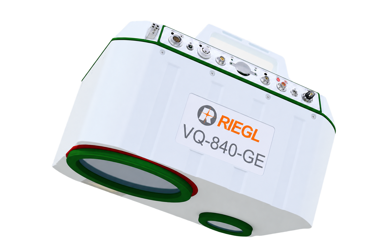
RIEGL VQ-840-GE Topo-Bathymetric Airborne LiDAR System
Price Available Upon Request
The RIEGL VQ-840-GE is a compact, fully integrated topo-bathymetric airborne LiDAR system for combined topographic and shallow-water surveying. It provides measurement rates up to 200 kHz, a 532 nm green laser, 20 mm accuracy, 15 mm precision, integrated IMU/GNSS, and an integrated 24 MPixel digital camera, with support for UAVs, helicopters, and fixed-wing aircraft.
Product Overview
The RIEGL VQ-840-GE is a compact, fully integrated airborne LiDAR system designed for combined topographic and bathymetric surveying.
Its compact and lightweight design supports integration with UAVs, while the complete system includes an integrated, factory-calibrated IMU/GNSS system and an integrated 24 MPixel digital camera.
The system uses a narrow, visible green laser beam to measure underwater topography. Depending on water clarity, the 532 nm laser wavelength can penetrate water and enable measurement of submerged targets.
Key Features
- Measurement rate up to 200 kHz
- Integrated 24 MPixel digital camera
- Integrated inertial navigation system
- Designed for combined topographic and bathymetric UAV-based surveying
- High-accuracy ranging based on echo digitization
- Online waveform processing
- Multiple-target capability
- Concurrent full waveform storage of all measurements
- Full waveform data can be used for subsequent waveform averaging
- Scan speed up to 100 scans/sec
- Straightforward integration with UAVs and crewed aircraft
- Compatible with stabilized platforms
- Compact and lightweight integrated system design
Topo-Bathymetric LiDAR Measurement
The RIEGL VQ-840-GE performs laser range measurements using a narrow, visible green laser beam emitted from a pulsed laser source.
At its 532 nm green wavelength, the laser beam can penetrate water when conditions permit, enabling measurements of submerged targets and underwater topography.
The distance measurement principle is based on:
- Time-of-flight measurement
- Very short laser pulses
- Echo digitization
- Online waveform processing
The laser beam is deflected using an elliptic scan pattern and reaches the water surface at an incidence angle with relatively low variation.
Integrated Navigation and Imaging
The VQ-840-GE includes an inertial navigation sensor used for subsequent estimation of the system’s position and orientation.
An integrated 24 MPixel digital camera supplements the LiDAR data with high-resolution imagery.
The all-in-one system configuration also includes an integrated and factory-calibrated IMU/GNSS system.
Rugged Airborne Design
The scanner incorporates a rugged internal mechanical structure and a dust- and splash-water-proof housing.
According to the supplied manufacturer information, this construction supports long-term operation on a range of airborne platforms, including:
- UAVs
- Helicopters
- Fixed-wing aircraft
Technical Data Overview
| Specification | 200 kHz | 100 kHz | 50 kHz |
|---|---|---|---|
| Measurement Rate | 200 kHz | 100 kHz | 50 kHz |
| Max. Water Depth Penetration in Secchi Depths | 1.7 | 1.8 | 2.0 |
| Minimum Range | 20 m | 20 m | 20 m |
| Accuracy / Precision | 20 mm / 15 mm | 20 mm / 15 mm | 20 mm / 15 mm |
| Laser Wavelength | 532 nm, green | 532 nm, green | 532 nm, green |
Performance
The RIEGL VQ-840-GE provides measurement rates up to 200 kHz and scanning speeds up to 100 scans per second, supporting high spatial resolution during airborne acquisition.
The system provides 20 mm accuracy and 15 mm precision across the measurement-rate configurations listed in the supplied technical overview.
Full Waveform Recording
In addition to online waveform processing, the VQ-840-GE supports concurrent comprehensive full waveform storage of all measurements.
The stored waveform data can subsequently be used for waveform averaging.
Main Applications
The RIEGL VQ-840-GE is intended for applications including:
- Coastline and Shallow Water Mapping
- Detection of Submerged and Floating Targets
- River Surveying
- Repeated Survey of Water Reservoirs
Software
RIEGL provides the following software packages for the RIEGL VQ-840-GE:
- RiPROCESS
- RiACQUIRE
- RiUNITE
For processing data acquired using RIEGL hydrography laser scanners, RiHYDRO is offered as an AddOn to RiPROCESS.
The RIEGL software environment is further complemented by:
- RiVLib
- RDBLib
- RiMAP Plugin for ArcGIS
| Weight | 5.4 kg |
|---|
Related products
Reviews
There are no reviews yet.