
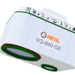
RIEGL VMY-2 Dual Scanner Mobile Mapping System
Price Available Upon Request
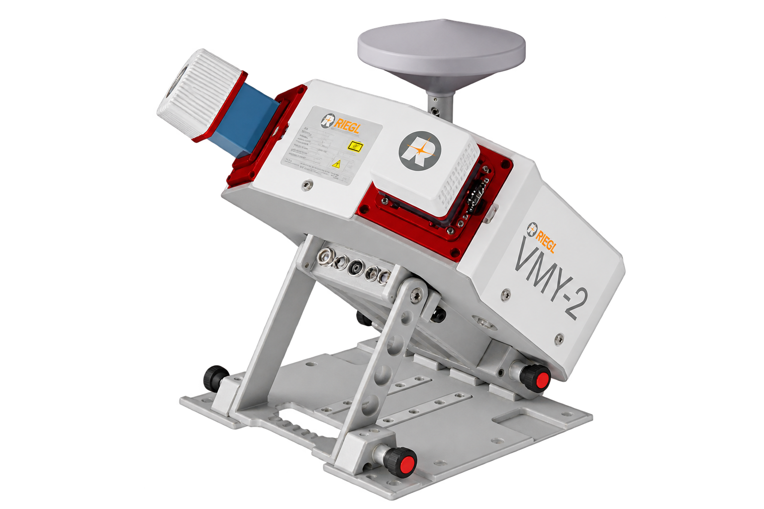
The RIEGL VMY-2 is a compact dual-scanner mobile mapping system using two RIEGL miniVUX-HA LiDAR scanners to reduce scan shadows during road, rail, and corridor mapping. It provides up to 270 m range, 5 mm accuracy, 4 mm precision, pulse repetition rates up to 600 kHz, 300 scan lines per second, a 360° field of view, fully integrated IMU/GNSS, and optional integration of up to four cameras.
Product Overview
The RIEGL VMY-2 is a compact dual-scanner mobile mapping system designed for a wide range of mobile mapping applications.
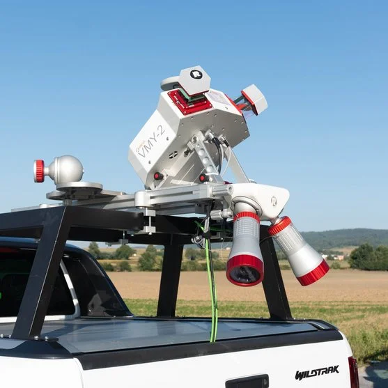
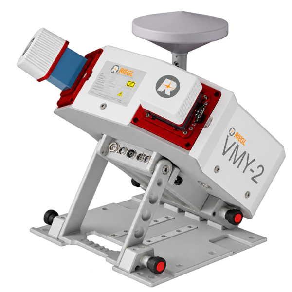
The system uses two RIEGL miniVUX-HA LiDAR scanners on a fold-down scanning platform. This dual-scanner configuration helps reduce scan shadows along roads and railways while supporting efficient acquisition of high-quality LiDAR data.
The VMY-2 also supports the optional integration of up to four cameras, enabling simultaneous image acquisition to complement the captured LiDAR data.
Key Features
- Dual RIEGL miniVUX-HA scanner configuration
- 4 mm precision
- 5 mm accuracy
- Laser pulse repetition rate of up to 600 kHz
- Up to 300 scan lines per second
- Maximum range up to 270 m
- Laser Class 1 eye-safe operation
- 360° field of view
- Multiple target capability
- Fully integrated IMU/GNSS system
- Optional integration of up to 4 cameras
- Fold-down scanner platform for easier mounting and storage
- Designed to reduce scan shadows along roads and railways
Dual-Scanner Configuration
The RIEGL VMY-2 operates two miniVUX-HA scanners. The dual-scanner arrangement is designed to reduce scan shadows during mobile mapping, particularly along roads and railway corridors.
According to the supplied manufacturer information, the dual-sensor platform can provide high-quality data at lower pulse rates, supporting faster data transfer and processing.
Imaging Integration
The VMY-2 supports simultaneous acquisition of LiDAR and imagery.
Up to four cameras can be optionally integrated with the system to complement the captured laser scanning data.
Integrated IMU/GNSS
The system includes a fully integrated IMU/GNSS system, supporting positioning and orientation during mobile mapping data acquisition.
Scanner Performance
The RIEGL VMY-2 provides:
- 5 mm accuracy
- 4 mm precision
- Up to 600 kHz laser pulse repetition rate
- Up to 300 scan lines per second
- Maximum range up to 270 m
- 360° field of view
- Multiple target capability
Technical Data Overview
| Specification | 200 kHz | 400 kHz | 600 kHz |
|---|---|---|---|
| Effective Measurement Rate | 200 kHz | 400 kHz | 600 kHz |
| Max. Range, Target Reflectivity (ρ ≥ 80%) | 270 m | 240 m | 200 m |
| Max. Range, Target Reflectivity (ρ ≥ 60%) | 240 m | 210 m | 170 m |
| Max. Range, Target Reflectivity (ρ ≥ 20%) | 140 m | 120 m | 100 m |
| Minimum Range | 1 m | 1 m | 1 m |
| Max. Number of Targets per Pulse | 5 | 5 | 5 |
| Accuracy / Precision | 5 mm / 4 mm | 5 mm / 4 mm | 5 mm / 4 mm |
Main Applications
The RIEGL VMY-2 is intended for mobile mapping applications including:
- GIS Mapping and Asset Management
- Transportation Infrastructure Mapping
- HD Mapping for Autonomous Vehicles
- City Modeling
- Rapid Capture of Construction Sites and Bulk Material
- Open-Pit Mine Surveying
- As-Built Surveying
The manufacturer also identifies the system as suitable for city and corridor mapping, asset management, and general mobile data acquisition projects.
Software
RIEGL provides the following software packages for the RIEGL VMY-2:
- RiPROCESS
- RiACQUIRE
- RiUNITE
These software packages are complemented by:
- RiVLib
- RDBLib
- RiMAP Plugin for ArcGIS
Mounting and Storage
The VMY series uses a fold-down laser scanning platform designed to improve mounting, handling, transport, and storage.
This compact configuration supports more convenient deployment while maintaining the dual-scanner arrangement required for mobile mapping.
Related products
Reviews
There are no reviews yet.