
RIEGL VQ-860-G High Performance Topo-Bathymetric Airborne Laser Scanner
Price Available Upon Request
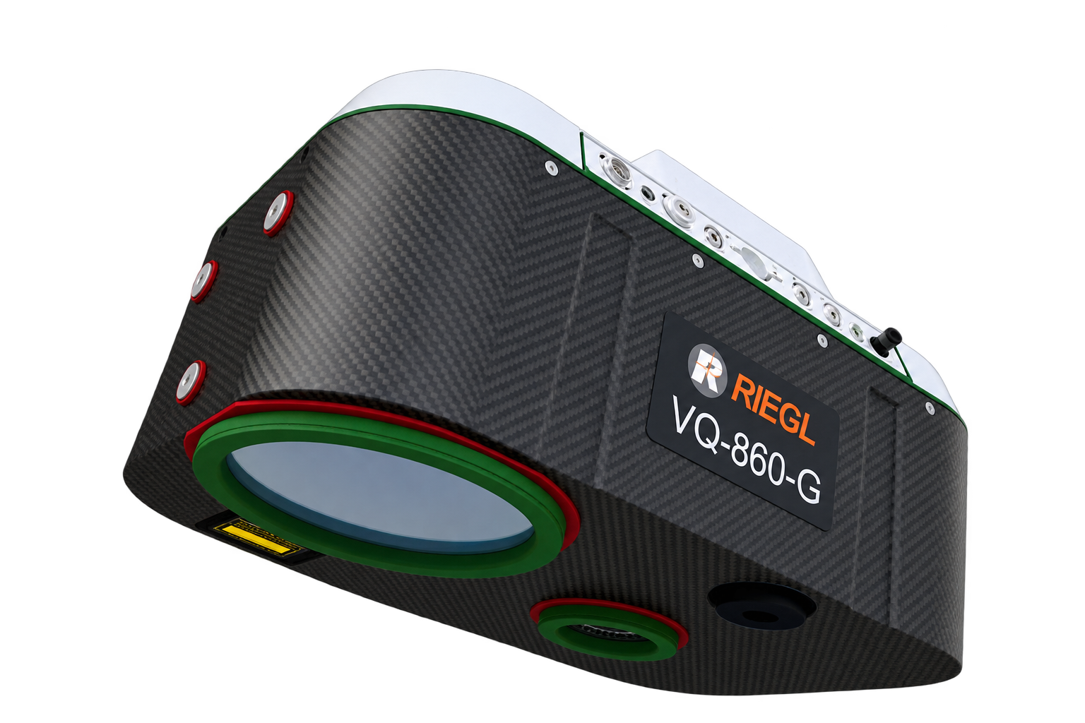
The RIEGL VQ-860-G is a high-performance topo-bathymetric airborne laser scanner designed for surveying inland and near-shore waters. It provides measurement rates up to 100 kHz, scan speeds up to 100 scans/sec, 20 mm accuracy, 15 mm precision, and water-depth penetration up to 2.5 Secchi depths, with optional integrated IMU/GNSS and digital camera systems.
Product Overview
The RIEGL VQ-860-G is a compact, high-performance airborne laser scanner designed for topographic and bathymetric surveying of inland waters and near-shore waters.
Its increased depth-penetration performance supports efficient bathymetric data acquisition, while the scanner’s configurable operating parameters allow its performance to be adapted to the aircraft altitude, aircraft speed, and survey objective.
The system is designed primarily for straightforward integration on crewed aircraft. With a weight of 15 kg (33 lbs), integration into drones is also possible.
An IMU/GNSS system and digital camera can be optionally integrated and factory calibrated.
Key Features
- Excellent depth performance
- Operational flight altitude range from 75 m to 500 m
- Measurement rates up to 100 kHz
- Scan speed up to 100 scans/sec
- 20 mm accuracy
- 15 mm precision
- Multiple-target capability
- High-accuracy ranging based on echo digitization
- Online waveform processing
- Comprehensive full waveform recording
- Optional integrated IMU/GNSS system
- Optional integrated digital camera
- Compact and robust airborne design
- Large internal storage capacity for increased operational autonomy
- Reduced laser-power operating mode for adapting to eye-safety requirements in sensitive areas
Topo-Bathymetric Laser Scanning
The RIEGL VQ-860-G performs laser range measurements for high-resolution surveying of underwater topography using a narrow, visible green laser beam emitted from a pulsed laser source.
Depending on water clarity, the laser beam can penetrate the water surface and enable measurements of submerged targets located on the seafloor and within the water column.
Waveform Processing
The scanner uses echo digitization and online waveform processing for high-accuracy ranging and supports multiple-target detection.
It also provides concurrent comprehensive storage of the full waveform data from all measurements, allowing subsequent waveform averaging during processing.
Operational Flexibility
The VQ-860-G can be configured according to the requirements of the individual survey project.
Its operating parameters can be adapted based on:
- Carrier aircraft altitude
- Carrier aircraft speed
- Mission objective
The specified operational flight altitude range extends from 75 m to 500 m.
Airborne Integration
The scanner is designed for integration with crewed aircraft, while its 15 kg weight also permits integration into drone platforms.
Its rugged internal mechanical structure and dust- and splash-water-proof housing support long-term operation on airborne platforms.
Technical Data Overview
| Specification | 50 kHz (Reduced) | 100 kHz | 50 kHz |
|---|---|---|---|
| Measurement Rate | 50 kHz | 100 kHz | 50 kHz |
| Max. Water Depth Penetration in Secchi Depths | 2.0 | 2.3 | 2.5 |
| Minimum Range | 50 m | 50 m | 50 m |
| Accuracy / Precision | 20 mm / 15 mm | 20 mm / 15 mm | 20 mm / 15 mm |
Performance
The RIEGL VQ-860-G provides measurement rates up to 100 kHz and scanning speeds up to 100 scans per second.
Across the operating modes listed in the supplied technical data, the scanner provides:
- 20 mm accuracy
- 15 mm precision
- Minimum range of 50 m
- Maximum water-depth penetration of up to 2.5 Secchi depths
Reduced Laser-Power Mode
The VQ-860-G provides an operational mode with reduced laser power. This mode allows the system to be adapted to eye-safety requirements when operating in sensitive areas.
Main Applications
The RIEGL VQ-860-G is intended for:
- Coastline Cartography
- Detection of Submerged and Floating Targets
- Surveying for Hydraulic Engineering
- Hydro-Archeological Surveying
- River Mapping
Software
RIEGL provides the following software packages for the RIEGL VQ-860-G:
- RiPROCESS
- RiACQUIRE
- RiUNITE
For processing data acquired with RIEGL hydrography laser scanners, RiHYDRO is available as an AddOn to RiPROCESS.
The RIEGL software environment is further complemented by:
- RiVLib
- RDBLib
- RiMAP Plugin for ArcGIS
| Weight | 15 kg |
|---|
Related products
Reviews
There are no reviews yet.