

iGUIDE PLANIX R1
Price Available Upon Request
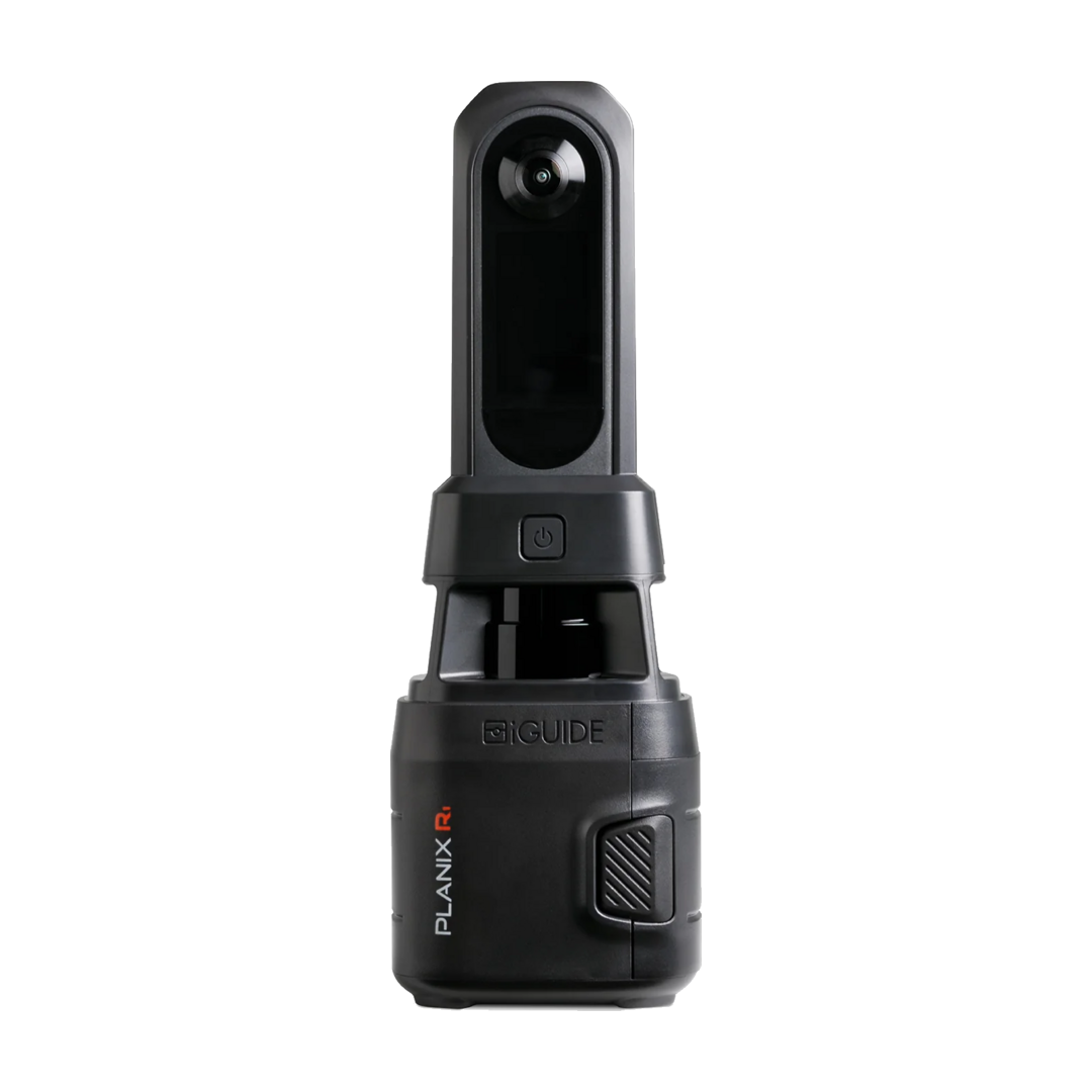
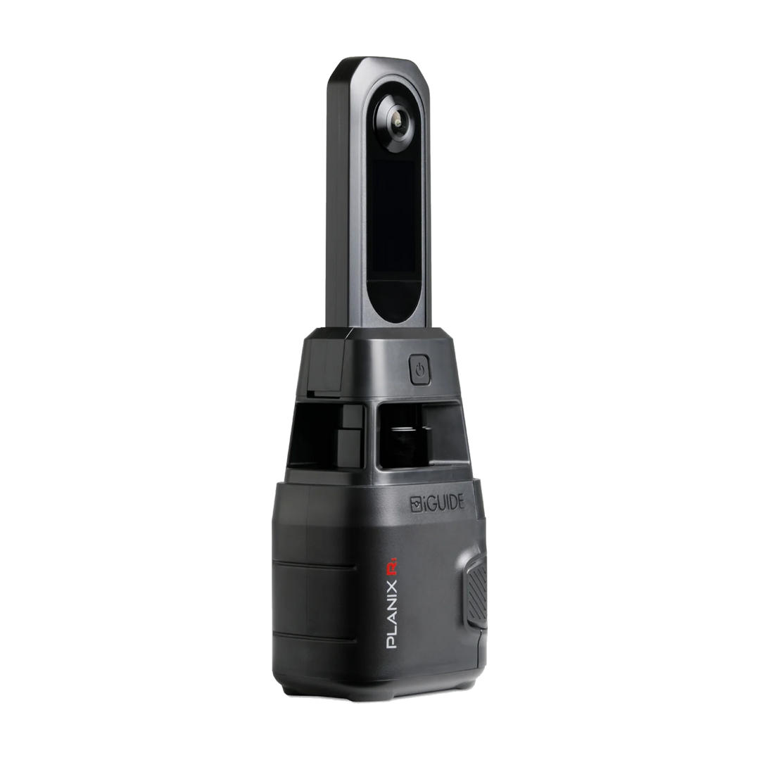
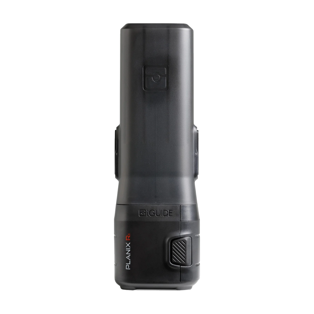
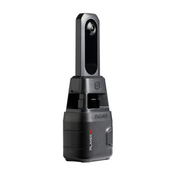
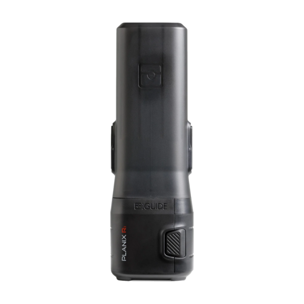
The iGUIDE PLANIX R1 is a professional-grade LiDAR scanning camera designed for efficient property capture. Featuring a 360° laser scanner, integrated 60 MP Ricoh THETA X camera, and a measurement range of up to 40 m, it captures the data required to produce 3D virtual tours, accurate floor plans, room-by-room measurements, and detailed property reports from a streamlined scanning workflow.
The iGUIDE PLANIX R1 is a professional-grade scanning camera designed for real estate professionals, appraisers, inspectors, and insurance adjusters. It is built to capture comprehensive property data during a single site visit and can be used to produce 3D virtual tours, accurate floor plans, room-by-room measurements, and property reports.
The system is designed for a straightforward room-by-room capture workflow, helping users collect the required property information without repeated scans or complex setups.
Key Features
- Professional-grade property scanning camera
- Designed for real estate, appraisal, inspection, and insurance workflows
- Produces 3D virtual tours
- Supports accurate floor plans
- Provides room-by-room measurements
- Supports detailed property reports
- Up to 40 m (approx. 130 ft) measurement range
- 360° laser scanner field of view
- Integrated Ricoh THETA X 360° camera
- High-resolution 60 MP image capture
- Built-in 2.4 GHz / 5 GHz Wi-Fi
- Uses the iGUIDE PLANIX App
- User-replaceable 12 V Li-Ion battery
- Up to 6 hours of typical operation
Professional Property Capture
The PLANIX R1 is designed to capture the data required for multiple property deliverables during one visit.
By walking through a property room by room, users can collect information that can be processed into:
- 3D virtual tours
- Floor plans
- Room-by-room measurements
- Property reports
This integrated workflow helps reduce the need to combine multiple separate capture tools and manual processes.
LiDAR Measurement Performance
The PLANIX R1 provides a measurement range of up to 40 metres (approximately 130 ft).
Its stated typical measurement uncertainty is:
- ±25 mm up to the maximum range for the raw point cloud
- Typically ±10 mm from the camera to the wall, based on a minimum wall length of 60 cm
The laser scanner provides a 360° field of view, supporting comprehensive property measurement during the capture process.
60 MP 360° Camera
The PLANIX R1 is equipped with a Ricoh THETA X 360° camera.
Camera Specifications
- Camera: Ricoh THETA X
- Resolution: 11,008 × 5,504 pixels
- Image Resolution: 60 MP
The high-resolution 360° imagery complements the system’s spatial measurement capabilities and supports detailed property documentation.
Connectivity and System Control
The PLANIX R1 includes built-in wireless connectivity for system control during property capture.
Connectivity
- Wi-Fi: 802.11 2.4 GHz / 5 GHz Access Point
- Survey Application: iGUIDE PLANIX App
Battery and Power
The PLANIX R1 uses a 12 V Li-Ion battery that is user-replaceable.
Electrical Specifications
- System Battery: 12 V Li-Ion
- Battery Type: User-replaceable
- Typical Operating Time: Up to 6 hours
- Power Supply Input: USB-C, 100–240 VAC, 50–60 Hz, 1.0 A
- Power Supply Output: 12 VDC, 1.8 A
Compact and Portable Design
The PLANIX R1 is designed for portable field operation and can be transported easily between properties and scanning locations.
Weight
- Without Cover: 725 g (1.76 lb)
- With Cover: 986 g (2.2 lb)
Dimensions
Without Cover
- Width: 9.90 cm (3.90 in)
- Depth: 7.75 cm (3.05 in)
- Height: 28.89 cm (11.375 in)
With Cover
- Width: 9.90 cm (3.90 in)
- Depth: 7.75 cm (3.05 in)
- Height: 29.53 cm (11.625 in)
Mounting
- Tripod Mounting Thread: 1/4-20
Environmental Specifications
The PLANIX R1 is designed to operate within the following environmental conditions:
- Operating Temperature: 5°C to 40°C (41°F to 104°F)
- Storage Temperature: -20°C to 60°C (-4°F to 140°F)
- Relative Humidity: 0–90%
- Maximum Operating Altitude: 2,000 m
What’s Included
The PLANIX R1 package includes:
- PLANIX R1 Camera System
- System shield
- Battery charger
- Battery with battery cover
- USB power supply
- 1.8 m (6 ft) USB-C cable
- Soft carrying case with strap
- Protective neoprene sleeve
Applications
The PLANIX R1 is designed for professionals working in areas such as:
- Real estate property capture
- Property appraisal
- Property inspection
- Insurance assessment
- Floor plan creation
- 3D virtual tours
- Room measurement
- Property documentation
PLANIX R1 Technical Specifications
Performance
- Measurement Range: Up to 40 m (approx. 130 ft)
- Typical Measurement Uncertainty: ±25 mm up to maximum range for raw point cloud; typically ±10 mm from camera to wall with minimum 60 cm wall length
- Laser Scanner Field of View: 360°
- 360° Camera: Ricoh THETA X
- Resolution: 11,008 × 5,504 pixels (60 MP)
Connectivity
- Wi-Fi: Wi-Fi 802.11 2.4 GHz / 5 GHz Access Point
- Survey App: iGUIDE PLANIX App
Electrical
- System Battery: 12 V Li-Ion, user-replaceable
- Battery Performance: Up to 6 hours of typical operation
- Power Supply Input: USB-C 100–240 VAC, 50–60 Hz, 1.0 A
- Power Supply Output: 12 VDC, 1.8 A
Mechanical
- Weight Without Cover: 725 g (1.76 lb)
- Weight With Cover: 986 g (2.2 lb)
- Dimensions Without Cover: 9.90 × 7.75 × 28.89 cm
- Dimensions With Cover: 9.90 × 7.75 × 29.53 cm
- Shipping Weight with Carrying Case, Without Packaging: 1,996 g (4.4 lb)
- Carrying Case Dimensions: 57.15 × 15.24 × 13.97 cm
- Tripod Mounting Thread: 1/4-20
Professional Scanning for Complete Property Data
The iGUIDE PLANIX R1 combines 360° laser scanning, high-resolution panoramic imaging, wireless system control, and portable operation in one professional property capture solution.
With a measurement range of up to 40 metres, a 60 MP Ricoh THETA X camera, a 360° laser scanner field of view, and up to 6 hours of typical battery operation, the system is designed to help property professionals efficiently capture the information required for digital property documentation and presentation.
| Weight | 0.986 kg |
|---|---|
| Dimensions | 9.90 × 7.75 × 29.53 cm |
| Choose Variant | PLANIX R1, PLANIX R1 + Extra Battery, PLANIX R1 + Tripod |
Related products

Reviews
There are no reviews yet.