
RIEGL miniVUX-3UAV Airborne LiDAR Sensor
Price Available Upon Request
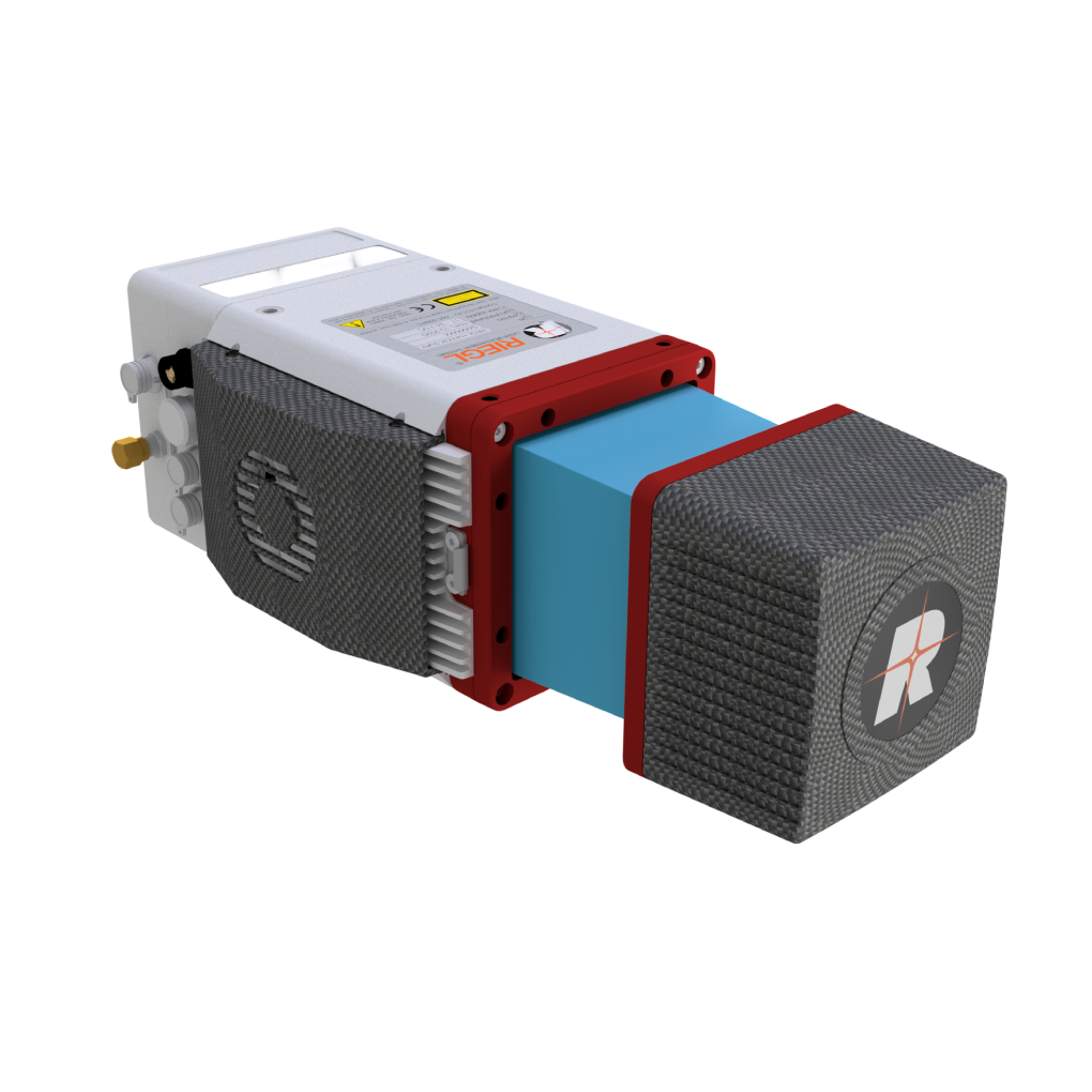
The RIEGL miniVUX-3UAV is an extremely lightweight airborne LiDAR sensor designed for UAS/UAV/RPAS integration. It offers selectable 100 kHz, 200 kHz, and 300 kHz laser pulse repetition rates, measurement rates up to 200,000 measurements/sec, scan speeds up to 100 scans/sec, a 360° field of view, and multiple target capability with up to 5 target echoes per laser shot. Weighing 1.55 kg, it also supports RIEGL RiLOC IMU/GNSS system solutions for complete UAV-based LiDAR surveying.
Overview
The RIEGL miniVUX-3UAV is an extremely lightweight airborne laser scanner designed specifically for integration with UAS/UAV/RPAS platforms.
The sensor offers selectable 100 kHz, 200 kHz, and 300 kHz laser pulse repetition rates (PRR). At 300 kHz PRR, it provides up to 100,000 measurements per second at a 120° field of view, producing a dense point pattern for UAV-based applications requiring the acquisition of small objects.
Its compact aluminum housing provides multiple integration options for platforms with limited space or payload capacity, while the 360° field of view enables complete environmental acquisition.
Key Features
- Selectable 100 kHz / 200 kHz / 300 kHz laser PRR
- Measurement rate up to 200,000 measurements/sec
- Scan speed up to 100 scans/sec
- Very compact and lightweight (1.55 kg / 3.4 lbs)
- Up to 360° field of view
- Robust aluminum housing
- Ready for mounting on multi-rotor, rotary-wing, and fixed-wing UAVs
- Echo signal digitization and online waveform processing
- Multiple target capability with up to 5 target echoes per laser shot
- Mechanical and electrical interface for IMU mounting
- RIEGL RiLOC IMU/GNSS system solutions available
- Exceptionally well suited for measuring snowy and icy terrain
- User-friendly integration solutions
Integration & Data Handling
The scanner features:
- Easy-to-remove SD card for data storage
- LAN-TCP/IP interface for scan data streaming
- Low power consumption for straightforward integration with UAS/UAV/RPAS platforms
RIEGL RiLOC-E25 System Solution
The RiLOC-E25 combines:
- MEMS Inertial Measurement Unit (IMU)
- GNSS unit
- Appropriate software
All components are integrated into a compact housing attached directly to the miniVUX-3UAV, providing a complete LiDAR system for small-scale drone surveying.
Main Applications
- Agriculture & Forestry
- Glacier and Snowfield Mapping
- Archeology and Cultural Heritage Documentation
- Construction-Site Monitoring
- Landslide Monitoring
Technical Specifications
| Specification | 100 kHz | 200 kHz (Reduced Power) | 200 kHz | 300 kHz |
|---|---|---|---|---|
| Laser Pulse Repetition Rate (PRR) | 100 kHz | 200 kHz | 200 kHz | 300 kHz |
| Maximum Measuring Range (p ≥ 20%) | 170 m | 150 m | 170 m | 170 m |
| Maximum Measuring Range (p ≥ 60%) | 290 m | 250 m | 290 m | 290 m |
| Maximum Measuring Range (p ≥ 80%) | 330 m | 280 m | 330 m | 330 m |
| Maximum Targets per Pulse | 5 | 5 | 5 | 5 |
| Minimum Range | 2 m | 2 m | 2 m | 2 m |
| Accuracy / Precision | 15 mm / 10 mm | 15 mm / 10 mm | 15 mm / 10 mm | 15 mm / 10 mm |
| Weight | 1.55 kg |
|---|
Related products
Reviews
There are no reviews yet.