
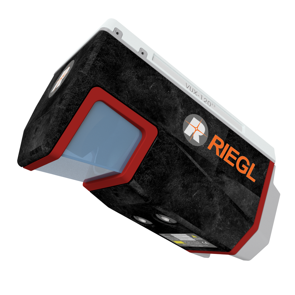
RIEGL VUX-120 Airborne Laser Scanner
Price Available Upon Request
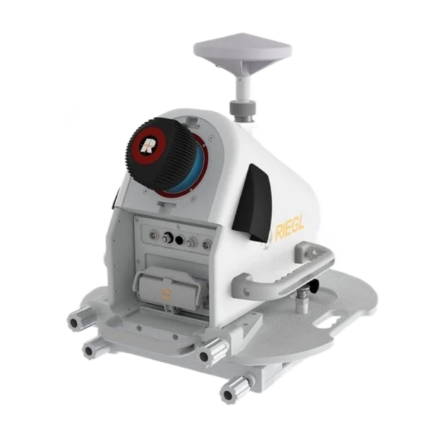
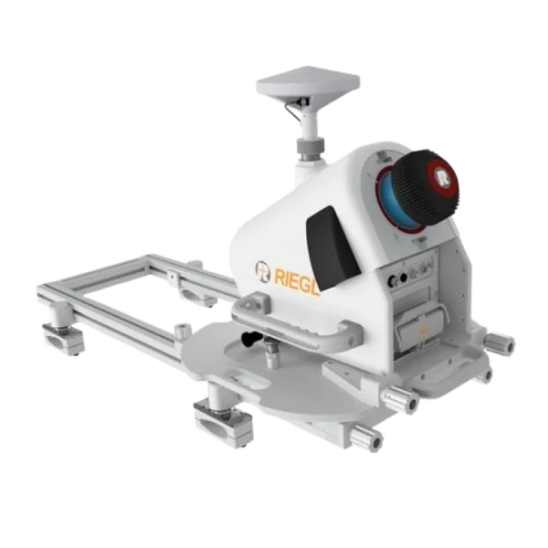
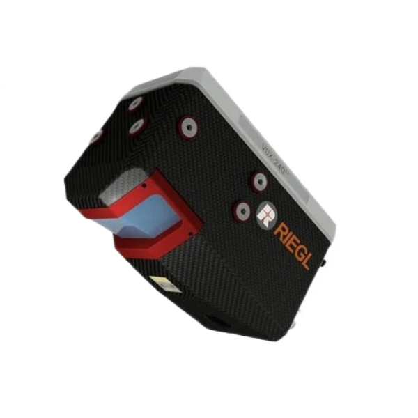
The RIEGL VUX-120 is a lightweight airborne laser scanner featuring Nadir/Forward/Backward scanning, a 100° field of view, laser pulse repetition rates up to 2.4 MHz, 2 TByte internal storage, and interfaces for IMU/GNSS integration and up to two external cameras. It is designed for integration with UAVs, small manned aircraft, and helicopters.
Overview
The RIEGL VUX-120 is a lightweight and versatile airborne laser scanner featuring a 100° field of view and a laser pulse repetition rate of up to 2.4 MHz. Its Nadir/Forward/Backward (NFB) scanning alternates the measuring beam between strictly nadir, +10° forward, and -10° backward to provide enhanced completeness of data capture, particularly in environments with vertical surfaces and narrow canyons.
The scanner includes 2 TByte internal data storage, a removeable CFast card, interfaces for external IMU/GNSS integration, and support for up to two optional external cameras.
Its design enables integration with UAS/UAV/RPAS, small manned aeroplanes (such as gyro-copters), and helicopters. It is available as a stand-alone UAV LiDAR sensor or as part of fully integrated UAV-based laser scanning system configurations with an appropriate IMU/GNSS system and optional cameras.
RIEGL RiLOC-F IMU/GNSS Solution
The RIEGL RiLOC-F is a fully integrated localization and orientation solution for the VUX-series.
It includes:
- High-precision MEMS Inertial Measurement Unit (IMU)
- GNSS unit
- Appropriate software
- Compact and lightweight housing directly attached to the scanner
The combination of the LiDAR sensor and RiLOC-F forms a compact LiDAR system intended for small-scale LiDAR surveying with drones. In such applications, using a nearby local base station ensures the shortest base length and maximum accuracy in the georeferencing of the high-precision LiDAR data.
Main Features
- Laser pulse repetition rate up to 2.4 MHz
- Measurement rate up to 2,000,000 measurements/second
- Scan speed up to 400 lines/second
- Operating flight altitude up to 720 m (2,350 ft)
- Field of View up to 100°
- Compact & lightweight (2.3 kg)
- Nadir/Forward/Backward Scanning for enhanced completeness of scan data on vertical structures and narrow canyons
- Easily mountable to unmanned platforms (UAVs) and small manned aircraft
- Echo signal digitization
- Multiple target capability
- Online waveform processing
- Multiple-time-around processing
- Mechanical and electrical interface for IMU/GNSS integration
- RIEGL RiLOC IMU/GNSS system solutions available
- Interfaces for up to 2 external cameras
- Scan data storage on internal SSD memory
- Removeable CFAST® memory card
Main Applications
- Corridor Mapping
- Power Line Inspection
- Railway Track Inspection
- Pipeline Inspection
- Topography in Open-Cast Mining
- Surveying of Urban Environments
- Archaeology and Cultural Heritage Documentation
- Agriculture & Forestry
Technical Data Overview
| Specification | 150 kHz | 300 kHz | 600 kHz | 1200 kHz | 1800 kHz | 2400 kHz |
|---|---|---|---|---|---|---|
| Laser Pulse Repetition Rate (PRR) | 150 kHz | 300 kHz | 600 kHz | 1200 kHz | 1800 kHz | 2400 kHz |
| Max. Measuring Range (p ≥ 20%) | 760 m | 550 m | 400 m | 280 m | 230 m | 200 m |
| Max. Measuring Range (p ≥ 60%) | 1260 m | 920 m | 670 m | 480 m | 400 m | 350 m |
| Max. Measuring Range (p ≥ 80%) | 1430 m | 1050 m | 760 m | 550 m | 450 m | 400 m |
| Max. Number of Targets per Pulse | 32 | 32 | 24 | 11 | 7 | 5 |
| Minimum Range | 5 m | 5 m | 5 m | 5 m | 5 m | 5 m |
| Accuracy / Precision | 10 mm / 5 mm | 10 mm / 5 mm | 10 mm / 5 mm | 10 mm / 5 mm | 10 mm / 5 mm | 10 mm / 5 mm |
| Weight | 2.3 kg |
|---|
Related products
Reviews
There are no reviews yet.