
RIEGL miniVUX-4UAV LiDAR Sensor for UAV-Based Laser Scanning
Price Available Upon Request
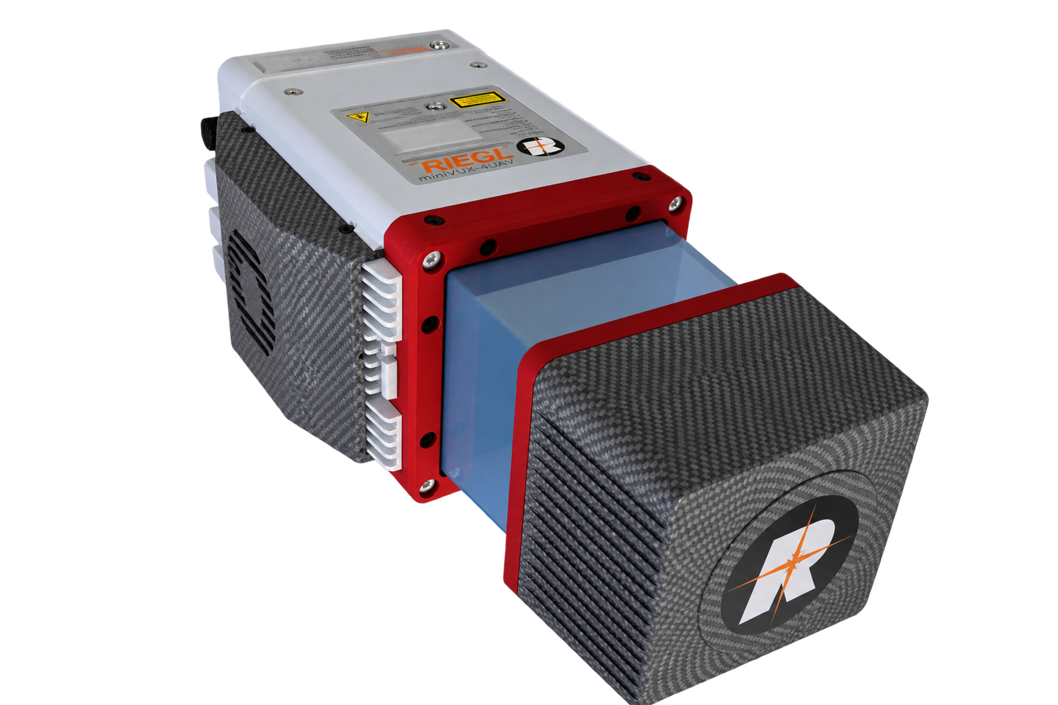
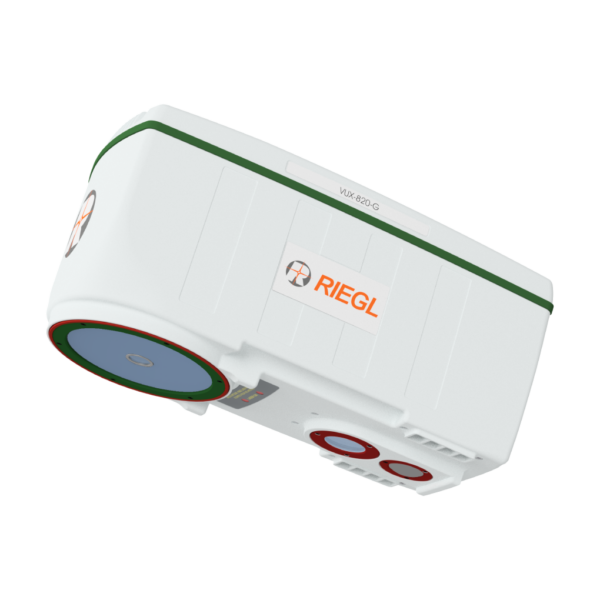
The RIEGL miniVUX-4UAV is an extremely lightweight UAV LiDAR sensor offering selectable pulse repetition rates up to 400 kHz, measurement rates up to 200,000 measurements/sec, scan speeds up to 150 scans/sec, a field of view up to 360°, 12 mm accuracy, and 8 mm precision. Weighing just 1.55 kg, it supports multi-rotor, rotary-wing, and fixed-wing UAV integration, multiple-target detection, and optional RIEGL RiLOC IMU/GNSS solutions.
1. Product Title
RIEGL miniVUX-4UAV LiDAR Sensor for UAV-Based Laser Scanning
2. Long Description
Product Overview
The RIEGL miniVUX-4UAV is an extremely lightweight airborne LiDAR sensor designed specifically for integration with UAS/UAV/RPAS platforms.
It offers selectable laser pulse repetition rates of 100 kHz, 200 kHz, 300 kHz, and 400 kHz, a measurement rate of up to 200,000 measurements/sec, and scan speeds up to 150 scans/sec.
With a field of view of up to 360°, improved laser beam divergence, 12 mm accuracy, and 8 mm precision, the sensor is designed to generate dense point patterns and detailed data for UAV-based surveying applications.
Key Features
- Selectable laser PRR:
- 100 kHz
- 200 kHz
- 300 kHz
- 400 kHz
- Measurement rate up to 200,000 measurements/sec
- Scan speed up to 150 scans/sec
- Field of view up to 360°
- 12 mm accuracy
- 8 mm precision
- Compact and lightweight design at 1.55 kg / 3.4 lbs
- Multiple-target capability
- Up to 5 target echoes per laser shot
- Echo signal digitization
- Online waveform processing
- Mechanical and electrical interface for IMU mounting
- RIEGL RiLOC IMU/GNSS solutions available
- Robust aluminum housing
- Suitable for multi-rotor, rotary-wing, and fixed-wing UAVs
- Designed for application- and installation-oriented system integration
UAV-Based LiDAR Performance
The RIEGL miniVUX-4UAV is designed for detailed airborne laser scanning from UAV platforms.
At 400 kHz PRR, the source states that the sensor provides up to 133,333 measurements/sec at 120° field of view, supporting a dense point pattern on the ground for applications requiring the detection of small objects.
The sensor’s improved laser beam divergence, combined with 12 mm accuracy and 8 mm precision, supports detailed point-cloud acquisition.
Field of View
The scanner supports a field of view of up to 360°.
The technical overview also identifies a specific 200 kHz reduced-power operating mode with 360° FOV.
Multiple-Target Capability
The miniVUX-4UAV uses RIEGL’s:
- Echo signal digitization
- Online waveform processing
- Multiple-target capability
The system can record up to 5 target echoes per laser shot.
IMU/GNSS Integration
The scanner includes mechanical and electrical interfaces for IMU mounting.
RIEGL also offers integrated system solutions using its proprietary RiLOC localization and orientation components.
RIEGL RiLOC-E25 and RiLOC-F
For integrated miniVUX-SYS configurations, the miniVUX-4UAV can be combined with a localization and orientation subsystem containing:
- MEMS IMU
- GNSS unit
- Appropriate software
The components are housed in a compact unit attached directly to the rear panel of the sensor.
Two RiLOC options are identified in the supplied source:
- RiLOC-E25 — cost-efficient version for small-scale applications
- RiLOC-F — high-precision version for maximum accuracy in georeferencing the LiDAR data
Airborne Platform Integration
The rugged aluminum housing is designed for mounting on:
- Multi-rotor UAVs
- Rotary-wing UAVs
- Fixed-wing UAVs
The sensor is available as a stand-alone unit as well as in integrated system configurations with camera and IMU/GNSS systems.
Technical Data Overview
| Specification | 100 / 200 kHz | 200 kHz Reduced Power, 360° FOV | 300 / 400 kHz |
|---|---|---|---|
| Laser Pulse Repetition Rate PRR | 100 / 200 kHz | 200 kHz | 300 / 400 kHz |
| Max. Measuring Range (ρ ≥ 20%) | 170 m | 150 m | 170 m |
| Max. Measuring Range (ρ ≥ 60%) | 290 m | 250 m | 290 m |
| Max. Measuring Range (ρ ≥ 80%) | 330 m | 280 m | 330 m |
| Max. Number of Targets per Pulse | 5 | 5 | 5 |
| Minimum Range | 2 m | 2 m | 2 m |
| Accuracy / Precision | 12 mm / 8 mm | 12 mm / 8 mm | 12 mm / 8 mm |
Physical Specifications
| Specification | Value |
|---|---|
| Weight | 1.55 kg |
| Dimensions | Not provided in source |
| Field of View | Up to 360° |
| Maximum Measurement Rate | 200,000 measurements/sec |
| Maximum Scan Speed | 150 scans/sec |
Environmental and Terrain Use
The supplied manufacturer information specifically identifies the miniVUX-4UAV as being well suited for measurements in snowy and icy terrain.
Main Applications
The RIEGL miniVUX-4UAV is intended for:
- Agriculture & Forestry
- Archeology and Cultural Heritage Documentation
- Construction-Site Monitoring
- Topographic & Corridor Mapping
- Snow, Glacier and Environmental Mapping
- Slope, Landslide & Erosion Monitoring
Software
RIEGL provides the following software packages for the RIEGL miniVUX-4UAV:
- RiPROCESS
- RiACQUIRE
- RiUNITE
These are complemented by:
- RiVLib
- RDBLib
- RiMAP Plugin for ArcGIS
Related products
Reviews
There are no reviews yet.