
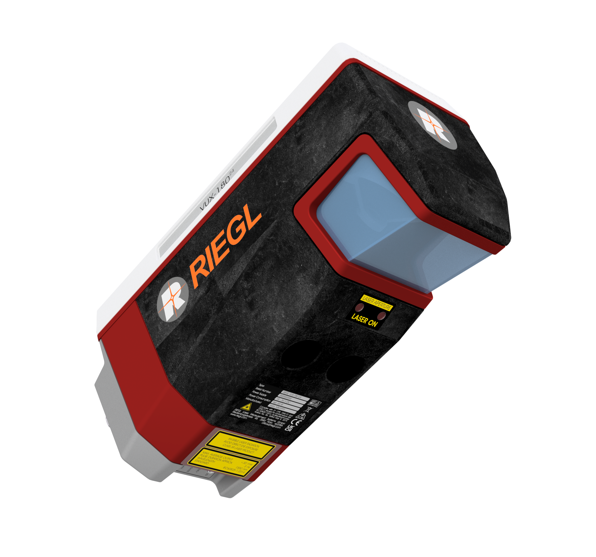
RIEGL VUX-18024 UAV LiDAR Sensor
Price Available Upon Request
The RIEGL VUX-180²⁴ is a lightweight airborne LiDAR sensor for high-speed UAV and corridor mapping applications, offering pulse repetition rates up to 2.4 MHz, scan speeds up to 800 lines/sec, measurement rates up to 2,000,000 measurements/sec, a 75° field of view, 10 mm accuracy, and 5 mm precision. Its 2.7 kg design supports UAVs and small crewed aircraft, with internal SSD storage, removable CFast® media, IMU/GNSS integration, and interfaces for up to five external cameras.
Product Overview
The RIEGL VUX-180²⁴ is a lightweight and versatile airborne LiDAR scanner designed for high-speed UAV-based laser scanning and corridor mapping.
It combines a wide 75° field of view, laser pulse repetition rates up to 2.4 MHz, and scan speeds up to 800 lines/second. These capabilities support high-speed surveying missions and applications requiring dense, well-distributed LiDAR measurements.
The sensor can be integrated with UAVs, fast-flying UAS/RPAS platforms, small crewed aircraft, and helicopters. It is available as a stand-alone LiDAR sensor as well as in integrated system configurations with an appropriate IMU/GNSS solution and optional cameras.
Key Features
- Scan speed up to 800 lines/second
- Laser pulse repetition rate up to 2.4 MHz
- Measurement rate up to 2,000,000 measurements/sec
- Operating flight altitude up to 980 m / 3,250 ft
- Field of view up to 75°
- 10 mm accuracy
- 5 mm precision
- Compact and lightweight design at 2.7 kg / 5.9 lbs
- Multiple-target capability
- Echo signal digitization
- Online waveform processing
- Multiple-time-around processing
- Mechanical and electrical interfaces for IMU/GNSS integration
- Interfaces for up to 5 external cameras
- Internal SSD data storage
- Removable CFast® memory card
- Internal storage capacity of 2 TByte
Waveform-LiDAR Technology
The RIEGL VUX-180²⁴ uses RIEGL’s Waveform-LiDAR technology, incorporating:
- Echo signal digitization
- Online waveform processing
- Multiple-target capability
- Multiple-time-around processing
Its multi-target capability supports penetration of dense foliage by distinguishing multiple echoes returned from a single laser pulse.
High-Speed Data Acquisition
With scan speeds up to 800 lines per second and laser pulse repetition rates up to 2.4 MHz, the VUX-180²⁴ is designed for applications where high platform speed and dense point distribution are required.
The maximum stated measurement rate is 2,000,000 measurements per second.
Data Storage
The scanner provides:
- 2 TByte internal data storage
- Internal SSD memory
- Removable CFast® memory card
These storage options support onboard recording during airborne acquisition missions.
IMU/GNSS Integration
The VUX-180²⁴ provides mechanical and electrical interfaces for integration with an external IMU/GNSS system.
RIEGL also offers an integrated configuration using the RIEGL RiLOC-F localization and orientation solution.
RIEGL RiLOC-F Option
The RiLOC-F-equipped version of the VUX-180²⁴ incorporates:
- High-precision MEMS IMU
- GNSS unit
- Associated software
These components are integrated in a compact and lightweight housing attached directly to the scanner.
According to the supplied manufacturer information, using a nearby local base station in drone-based surveying supports short GNSS baseline lengths and consequently high georeferencing accuracy for the acquired LiDAR data.
Camera Integration
The scanner provides interfaces for integration of up to five optional external cameras.
This allows LiDAR acquisition to be complemented with imagery when required by the survey configuration.
Airborne Platform Integration
The VUX-180²⁴ is designed for integration with:
- UAVs / UAS / RPAS
- Small crewed aircraft
- Helicopters
Its compact 2.7 kg design facilitates installation on lightweight airborne platforms.
Technical Data Overview
| Specification | 300 kHz | 600 kHz | 1200 kHz | 1800 kHz | 2400 kHz |
|---|---|---|---|---|---|
| Laser Pulse Repetition Rate PRR | 300 kHz | 600 kHz | 1200 kHz | 1800 kHz | 2400 kHz |
| Max. Measuring Range (ρ ≥ 20%) | 810 m | 590 m | 420 m | 350 m | 300 — unit missing in supplied source |
| Max. Measuring Range (ρ ≥ 60%) | 1340 m | 980 m | 710 m | 590 m | 510 m |
| Max. Measuring Range (ρ ≥ 80%) | 1520 m | 1120 m | 810 m | 670 m | 590 m |
| Max. Number of Targets per Pulse | 32 | 24 | 11 | 7 | 5 |
| Minimum Range | 5 m | 5 m | 5 m | 5 m | 5 m |
| Accuracy / Precision | 10 mm / 5 mm | 10 mm / 5 mm | 10 mm / 5 mm | 10 mm / 5 mm | 10 mm / 5 mm |
Physical Specifications
| Specification | Value |
|---|---|
| Weight | 2.7 kg |
| Dimensions | Not provided in source |
| Internal Storage Capacity | 2 TByte |
| Field of View | Up to 75° |
| Operating Flight Altitude | Up to 980 m / 3,250 ft |
Main Applications
The RIEGL VUX-180²⁴ is intended for:
- High-Speed Corridor Mapping
- High-Density LiDAR Applications
- Mapping and monitoring of power lines
- Railway track mapping and monitoring
- Pipeline mapping
- Runway surveying
- Topography in Open-Cast Mining
- Surveying of Urban Environments
- Agriculture & Forestry
Software
RIEGL provides the following software packages for the RIEGL VUX-180²⁴:
- RiPROCESS
- RiACQUIRE
- RiUNITE
These software packages are complemented by:
- RiVLib
- RDBLib
- RiMAP Plugin for ArcGIS
Related products
Reviews
There are no reviews yet.